 Acatenango Volcano Tours
Is Hiking Acatenango Safe? Honest Answer + Who Shouldn't Go
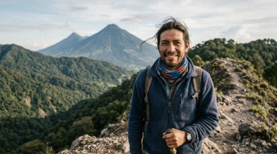
Is hiking Acatenango safe? Guided, with a certified operator, yes, genuinely. The record backs that up once you separate what actually hurts people here from what people assume will hurt them. Fuego throws lava across the saddle most nights and has done since 2002, and it is not the thing that has killed hikers on this mountain. Cold has. I have guided this route since 2016, and the night I remember most is not an eruption, it is a cold front in January 2017 that caught a group without the right gear and killed six people on the other side of the ridge from where I was standing. This guide covers that record plainly, the CONRED alert system that governs the trail, altitude sickness at camp, and who should genuinely stay home.
Quick answer
Hiking Acatenango is statistically safe with a certified guide: the mountain itself is dormant, and the two things that have actually killed people here are a 2017 cold-front hypothermia incident and a 2018 Fuego eruption that struck villages on the volcano's southern flank, not camps on Acatenango. It genuinely is not risk-free, and cold and altitude, not lava, are the real hazards a hiker needs to plan for.
Key takeaways
- The real risks are cold and altitude sickness, not the erupting volcano across the saddle
- CONRED, Guatemala's disaster-coordination agency, runs a four-level alert system; orange suspends summit options
- A certified guide is required under CONRED and INGUAT rules on every route up this mountain
- Camp temperatures run near freezing every month and drop to 0 to 5°C in December and January
- See the restrictions table below before booking if you have a heart, lung or mobility condition
- The two risks worth planning for are cold and altitude, not lava: pick from the certified Acatenango guides we compare and read their gear list before you book
Who Should Reconsider This Hike
If You have a diagnosed heart or lung condition
talk to your doctor first; sustained exertion at 3,750 m with roughly 40% less oxygen than sea level adds real cardiovascular load
If You are pregnant
most operators we compare do not recommend this hike during pregnancy; ask directly before booking
If You cannot walk uphill for four to six hours at home
consider the 4x4 jeep tour or the Pacaya day trip instead, which trims the climb or the altitude
If You have never slept above 2,000 m
spend a night or two in Antigua first if your schedule allows; it measurably reduces altitude symptoms at camp
If You are travelling with a young child
check the operator's own age policy directly, since the cold and the altitude are harder on small bodies than the walking is
Is Acatenango Itself Dangerous?
No, and this is the confusion worth clearing up first. Acatenango is dormant. It is not the volcano erupting; Fuego is, and Fuego is a separate cone about 3 km away across a saddle. Camps sit on Acatenango's flank, facing Fuego, but outside the mapped pyroclastic flow paths, which run south and west down Fuego's own slopes toward the villages below it, not toward the camps.
That distinction matters because most of what shows up in a search for "is hiking Acatenango safe" is really footage or news of Fuego, and the two get conflated constantly. Acatenango's own hazard profile is closer to a long, high-altitude uphill walk than to standing near an active vent. The genuine dangers on this mountain, in order of how often they actually hurt someone, are cold, dehydration, altitude and loose footing, in roughly that order. None of those are exotic; all of them are manageable with the right gear and a guide who knows when to slow a group down or turn it around.
What Actually Kills People Up Here
On 8 January 2017, six Guatemalan hikers died of hypothermia on Acatenango after a cold front moved in on a group that was not equipped for it. It remains the worst single incident on this specific mountain, and it happened with no eruption involved at all, just a sudden drop in temperature at altitude on people wearing the wrong layers. I was guiding a different route that same week and remember how fast the weather turned; camp went from a clear evening to driving wind and near-zero visibility inside two hours.
That incident is the reason serious operators now treat gear checks and weather calls as non-negotiable rather than optional upsells. A sleeping bag rated to only a few degrees below freezing is not a formality at 3,750 m when a front moves through; it is what keeps a bad night from becoming an emergency. Camp temperatures sit around freezing in every month of the year and drop to 0 to 5°C in December and January specifically, with wind chill on the exposed summit push pulling that down near -10°C. That is the number a hiker should actually be planning around, not the volcano across the saddle.
There Is No Quick Way Down
The other fact that shapes every safety decision on this mountain: there is no water source above the La Soledad trailhead and no vehicle access to camp, so evacuation from altitude means walking down, on the same trail you walked up, however long that takes in the dark or in bad weather. Guides carry radios and a first-aid kit for exactly this reason, and a competent operator will start a slow hiker down early rather than wait for a crisis at 3,750 m with no road anywhere near camp.
Fuego's Record and What CONRED Does About It
Fuego has erupted in a continuous Strombolian cycle since 2002, and INSIVUMEH, Guatemala's volcanology institute, logged up to 13 explosions an hour in 2026. That constant activity is exactly why nearly every group camping on Acatenango's flank sees something most nights: this is not a rare event you get lucky with, it is a volcano that is almost always doing something.
The honest part of this record is the eruption on 3 June 2018, which killed at least 190 people and destroyed base camps that were in use at the time, on Fuego's own southern flank, in villages and camps positioned much closer to the vent and in the path of pyroclastic flows than anywhere current Acatenango operators camp. Camps here were repositioned after that event, further from Fuego's cone and outside those mapped flow paths. I will not pretend that day did not happen, and I will not name any operator or describe what individual families went through; the facts that matter for a hiker deciding whether to book are the location of current camps and what changed afterward.
CONRED, the national disaster-coordination agency, runs a four-level alert system for the volcano: green for normal activity, yellow for monitored activity, orange, which suspends summit options, and red, which closes the routes outright. When an operator tells you the mountain is closed or a summit push is cancelled, that is CONRED's system working as intended, not an excuse. Last verified: August 2026, no CONRED closure was in effect for the standard Acatenango camping route; check an operator's current status before booking, since alert levels can change with little notice.
What Each CONRED Alert Level Means for Your Booking
The four levels decide what a guided group is allowed to do on any given day, and they change with little notice. Last verified: August 2026.
| Alert level | What it means | What happens to your hike |
|---|---|---|
| Green | Normal activity for a volcano that has erupted continuously since 2002 | Standard programme, camp and summit both run |
| Yellow | Activity elevated and monitored more closely | Camping continues, guides brief on turnaround points |
| Orange | Activity above the normal range | Summit options suspended, some operators camp lower |
| Red | Routes closed by the authority | Nobody walks, and your date moves or refunds under the operator's terms |
Altitude Sickness at 3,750 Metres
Acute mountain sickness affects about 25% of hikers at camp altitude, regardless of fitness level. That number surprises a lot of strong, active travellers who assume being fit at sea level protects them; it does not, reliably. Camp sits at roughly 3,750 m, and the summit at 3,976 m, high enough that headache, nausea, poor appetite and disturbed sleep are common even in people who run marathons at home.
The standard advice applies here as anywhere: go slowly on the climb, drink more water than feels necessary, and tell your guide the moment symptoms start rather than pushing through them alone. Diamox is sold over the counter in pharmacies in Antigua and some hikers take a course as a preventive measure; that is a conversation for a doctor or a travel clinic before your trip, not a call to make on the trail. Spending a night or two in Antigua at 1,530 m before the hike gives your body a real head start on acclimatisation, and it costs nothing but a bit of extra time in a town worth spending time in anyway. What to actually pack for the cold and the climb, including layers that make altitude nights more survivable, lives on our gear and packing guide.
Who Shouldn't Do This Hike: Restrictions at a Glance
None of the six operators we compare publish a formal medical exclusion list, so the rows below reflect honest, general guidance rather than a fixed rule any single company enforces. Ask directly before booking if any of these apply to you.
| Restriction | Typical rule on Acatenango tours | Why it exists | Ask before booking if... |
|---|---|---|---|
| Pregnancy | Generally not recommended by the operators we compare | Altitude, cold and uneven volcanic sand carry a real fall and exertion risk | You're pregnant at any stage |
| Age (children) | No published minimum across these six listings; policy varies by operator | Cold and altitude affect small bodies faster than the walking distance does | You're booking for a child; contact the operator's own listing directly |
| Age (older travellers) | No published maximum; fitness matters more than age here | The climb is 1,576 m of sustained vertical gain in one afternoon | You haven't done a multi-hour uphill walk recently |
| Heart or lung condition | No formal exclusion, but a genuine consideration | Roughly 40% less oxygen at camp altitude adds real cardiovascular strain | You have a diagnosed heart condition, asthma, or uncontrolled blood pressure |
| Fitness for the climb | Operators expect you can walk uphill for 4 to 6 hours with a light pack | There's no vehicle access to camp and no shortcut once you start | You rarely walk more than an hour without stopping at home |
| Mobility limitations | Not suitable on the standard routes | The trail is loose volcanic sand and forest footpath with no wheeled access | Standing and walking unassisted for several hours is difficult for you |
| Intoxication | Not permitted on any guided departure | Guides need sober hikers who can follow instructions instantly near loose ground or cold exposure | You or a companion plan to drink heavily the night before an early departure |
If any of these rule you out, the Pacaya day trip covers similar volcanic terrain at a fraction of the altitude and effort, with no overnight cold exposure at all.
How to Pick an Operator That Will Turn You Around
The single biggest safety lever a hiker controls on this mountain is which operator they book, not their own fitness. A guide who will actually stop a group, slow a struggling hiker, or call off a summit push in bad weather matters more than any piece of gear.
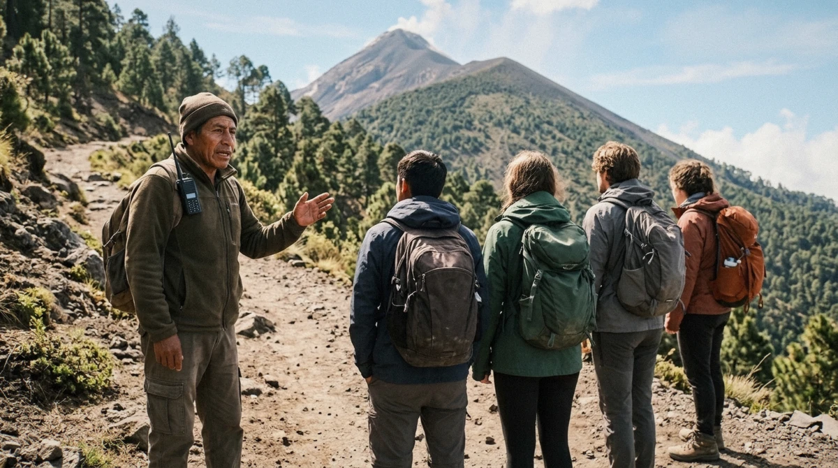
Ask directly before you pay: does the guide carry a radio and a first-aid kit, what is the actual guide-to-hiker ratio on the date you're booking, and what happens if someone in the group develops altitude symptoms at camp. A certified guide is required under CONRED and INGUAT rules on every legitimate operation here, and that requirement exists partly because robbery of unguided hikers on the lower slopes was the historic reason the guided system tightened in the first place; a guide is not a luxury add-on, it is the baseline.
Green flags: a real gear check before departure, a clear briefing on the weather and turnaround plan, and small enough groups that the guide can see everyone. The small-group cabin tour caps at a handful per guide specifically for this reason, and it publishes group size up front rather than leaving it vague. Red flags: an operator who rushes you past the waiver without reading it, or a guide who talks about squeezing in one more group on a day the weather looks marginal. Unattended bags at the trailhead are also worth a mention here, not a physical-safety issue but a property one; keep valuables in a dry bag or leave them at your hotel in Antigua, since the meeting point can get crowded before departure.
What Happens If the Weather Turns
A guide who sees a front building, the kind that caused the January 2017 incident, will shorten the summit push or hold the group at camp rather than push into it. That is the single lever within a guide's control that matters most, and it is worth booking an operator specifically for that judgment rather than the lowest price.
Booking through a platform gives you free cancellation up to 24 hours ahead with no payment taken today, which matters here because cloud and wind conditions can shift the plan on short notice. Book direct with some Antigua operators instead and the terms tighten considerably: refund policy is stricter and there is no refund at all for weather once the hike has started. The full breakdown of what each tour includes and what the cancellation terms actually look like lives on our pricing guide.
By Traveller Type: What to Actually Book
If First time at altitude, reasonably fit
book a guided overnight with a real ratio, like the $90 tour, and spend a night in Antigua first if your schedule allows
If Strong hiker, wants the smallest group
the small-group cabin tour caps its numbers per guide and sleeps you in a cabin instead of a tent
If Concerned about a medical condition
contact the operator directly before booking and get a straight answer, not a marketing brush-off
If Short on time, fitness or cold tolerance
the Pacaya day trip covers volcanic terrain in about 6 hours with no overnight altitude exposure
If Wants a guide who sets the pace to their exact needs
the private overnight puts one guide with your group only, useful if anyone needs to go slower
Questions People Ask Before Booking
Is hiking Acatenango safe?
Guided, yes, statistically. The mountain itself is dormant, and the documented risks are cold and altitude, not the erupting volcano across the saddle. A certified guide, proper cold-weather gear and a willingness to turn back if conditions worsen are what make the difference.
Has anyone died hiking Acatenango?
Yes. On 8 January 2017, six Guatemalan hikers died of hypothermia after a cold front hit an ill-equipped group. That remains the worst single incident specific to this mountain, and it happened with no eruption involved.
Is Acatenango an active volcano?
Acatenango itself is dormant. Fuego, the volcano you watch erupt from camp, is a separate cone about 3 km away that has erupted continuously since 2002. The two get confused constantly, since most footage people see is Fuego, not Acatenango.
Is it safe to hike while Fuego is erupting?
Fuego erupts almost every night, so "while it's erupting" describes most tour dates, not an exception. Camps sit outside the mapped pyroclastic flow paths, which run down Fuego's own flanks away from the camping area. CONRED's alert system, orange and red specifically, is what actually closes routes when activity genuinely escalates.
What happens if the trail is closed?
CONRED closes the routes at its red alert level, and a legitimate operator will not run a summit push against that. Free cancellation up to 24 hours ahead on a platform booking is what makes a closure a non-issue rather than a lost payment; see our pricing guide for how refund terms differ by operator.
Can beginners hike Acatenango?
Yes, with the right operator. Nothing on the standard route is technical; the challenge is 1,576 m of vertical gain in an afternoon and a night at 3,750 m where about 25% of hikers get some altitude symptoms. A first hike with a guided group that checks gear and sets a sensible pace is the safest way to try it.
Hiking Acatenango is safe for most people who go with a certified guide, and genuinely not for everyone. Cold and altitude, not the volcano, are what to actually plan around, and CONRED's alert system exists precisely so a bad night doesn't become the next incident on this record. Pick an operator whose gear check and turnaround policy you trust, more than one whose price is lowest, and check the certified Acatenango operators we compare before you commit to a date.